Seattle’s Most Dangerous Sidewalks: What You Must Know
Seattle’s Most Dangerous Sidewalks: What You Must Know
Seattle’s walkable charm hides a serious safety issue: many sidewalks and crossings pose significant risks. Knowing where these hotspots are can protect you and your loved ones. Vision Zero is Seattle Department of Transportation‘s commitment to “taking action to end traffic deaths and serious injuries on city streets by 2030.”
“Since Seattle began its Vision Zero efforts in 2015, over 1,688 people have been seriously injured and 228 people have been killed in a traffic crash.”
“More than 250 people in Seattle were injured last year in some sort of traffic collision,” SDOT data shows.
Seattle launched Vision Zero, in 2015 and since then the city has averaged about 28 traffic deaths per year—but “serious injury collisions are going up.”
Link to full article: Seattle has a long road ahead to eliminate all traffic deaths by 2030
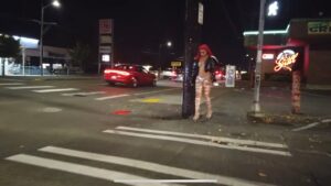
A High-Stakes Reality
- In 2024, Seattle recorded just 10 pedestrian fatalities, a decline from 20 in 2021 — yet city leaders stress that even one death is too many. (Source: Seattle Bike Blog — https://www.seattlebikeblog.com/2025/03/06/early-data-shows-seattle-halved-pedestrian-deaths-and-had-zero-bicycling-deaths-in-2024/
- In 2025, the first pedestrian fatality occurred only 4 days into the year in South Seattle on East Marginal Way just before 5 a.m. on January 4, 2025.
- More incidents have followed including May 16 a 60-year-old pedestrian at 14th Ave S and South Henderson Street at 11 p.m. in Seattle’s South Park neighborhood struck by 23-year-old driver.
- From 2015 through 2022, collision rates generally trended downward—but certain areas remain consistently dangerous.
(Source: Seattle DOT Vision Zero Action Plan — https://www.seattle.gov/documents/Departments/SDOT/VisionZero/VZ_Action_Plan.pdf
Dangerous Spots to Watch
Though public data is less granular than proprietary analytics, SDOT maps and Vision Zero reports highlight these hazard zones:
-
Aurora Avenue (SR-99): This high-speed corridor is infamous for frequent traffic violence and pedestrian fatalities. Advocacy groups have identified it as one of Seattle’s most dangerous stretches, citing its lack of sidewalks and heavy vehicle use. A high-speed arterial corridor where more than 20% of Seattle’s traffic fatalities occur. (Source: Cascade PBS — https://www.cascadepbs.org/news/2024/04/seattle-walkable-city-pedestrian-death-rates-show-otherwise/
-
Central areas of elevated pedestrian crashes include:
-
Lake City Way Northeast Like Aurora, this area has been flagged for elevated pedestrian risk due to high traffic volume and limited pedestrian infrastructure.
-
Downtown Core & Central Neighborhood Areas High-density pedestrian and vehicle activity in downtown Seattle, the University District, and Capitol Hill are hotspots for serious collisions. Between 2018–2022, neighborhoods like the U-District, Ravenna, and Laurelhurst accounted for 8% of the city’s crashes, while areas like West Seattle and White Center (though less dense) accounted for 22% of crashes.
-
Rainier Avenue South & MLK Jr. Way South These arterial corridors in South Seattle are major contributors to the city’s pedestrian fatality count.
-
University District Dense traffic & pedestrian flow increase collision risk.
(Source: Vision Zero data)
-
-
Tool for self-navigation: Use SDOT’s Traffic Volume & Crash Data Dashboards to visually explore crash heat maps at specific intersections and corridors.
(Source: Seattle DOT — https://www.seattle.gov/transportation/permits-and-services/interactive-maps/traffic-volume-and-crash-data
Core Causes of Danger
-
Turning collisions account for 35% of pedestrian crashes. Where Leading Pedestrian Intervals (LPIs) are implemented, turning injuries drop by 48%, and serious/fatal crashes decrease by 34%.
(Source: Seattle DOT LPI Report — https://www.seattle.gov/transportation/projects-and-programs/safety-first/vision-zero/leading-pedestrian-intervals - Fatal pedestrian accidents disproportionately occur on arterial streets, which make up only 7% of roadway miles but account for 61% of serious incidents.
(Source: Make Roads Safe — https://www.makeroadssafe.org/seattle-road-safety-overview-what-you-need-to-know/
What is Seattle Doing?
-
Vision Zero Action Plan targets high-risk areas with safety upgrades—crosswalk enhancements, expanded sidewalks, traffic-calming measures, and speed limit reductions.
(Source: Seattle DOT — https://www.seattle.gov/documents/Departments/SDOT/VisionZero/VZ_Action_Plan.pdf - The city has added 73 “No Turn On Red” intersections, a 75% increase to reduce right-turn-related pedestrian crashes.
(Source: Axios — https://www.axios.com/local/seattle/2024/02/21/no-turn-on-red-new-intersections
Safety Tips for Pedestrians
-
Always cross at marked crosswalks.
-
Ensure eye contact with drivers before crossing.
-
Stay alert—avoid phones and headphones near intersections.
-
Walk defensively—assume drivers may not see you.
Legal Support When Injured
If you are injured at a high-risk intersection—like the Aurora corridor, Rainier Avenue, or the University District—Brumley Law Firm is ready to help:
-
Seattle Pedestrian Accident Lawyer:
https://www.brumleylawfirm.com/pedestrian-accident-lawyer-seattle - Catastrophic Injury Attorney:
https://www.brumleylawfirm.com/catastrophic-injury-lawyer
Final Thoughts
While Seattle remains a great city for walking, it’s vital to remain vigilant—especially at intersections like Aurora Avenue, Rainier Avenue, or other arterial roadways. If an accident happens, we’re here to help you seek justice.